
Our Projects
Land Administration & Cadastral Mapping
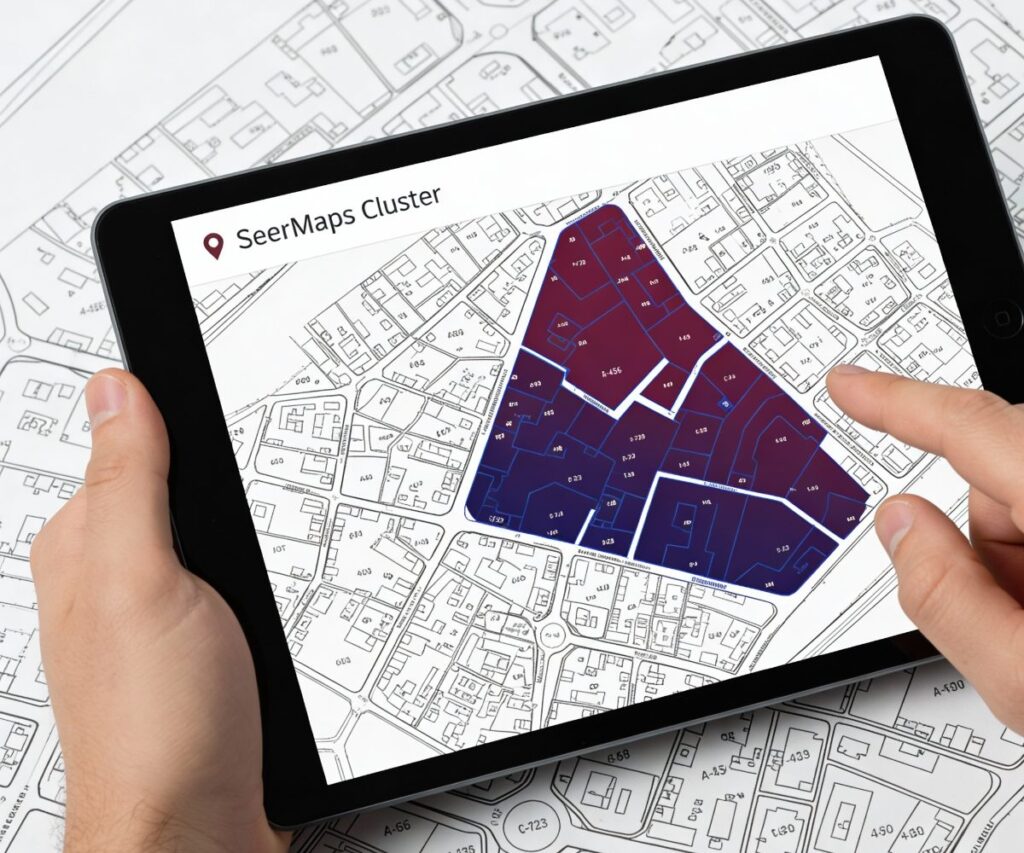
High-Precision Parcel Mapping (Australia)
SeerMaps executed a comprehensive digital parcel fabric modernization for a major Australian jurisdiction. By synthesizing legacy survey data, orthophotography, and existing title records, we engineered a topologically consistent geodatabase.
- Technical Scope: Cadastral digitization, topology rule enforcement, gap/overlap remediation.
- Outcome: A legally defensible land parcel fabric optimized for valuation, regulatory planning, and statutory compliance.
Spatial Rectification of Cadastral Maps (Pune, India)
We undertook the spatial rectification of legacy revenue maps, utilizing advanced rubber-sheeting and edge-matching techniques against DGPS control points. This process corrected historical positional errors, ensuring seamless integration with modern Electronic Total Station (ETS) data.
- Technical Scope: Georeferencing, vector correction, and coordinate geometry validation.
- Outcome: A spatial fabric ready for integration with e-governance platforms and land revenue records.
Svamitva Scheme Implementation (Rural India)
Under the Government of India’s flagship Svamitva framework, SeerMaps processed high-resolution drone imagery to delineate rural residential (Abhayadi) boundaries. We linked spatial entities with ownership attributes to support the issuance of authoritative Property Cards.
Outcome: Strengthened village-level land governance and established a formal property record system.
Utility Network Management & Water Resources
Wastewater Utility Network Modeling (Denver, USA)
For a Denver-based wastewater authority, we developed a geometric network model comprising sewer mains, laterals, and manholes. Integrating field GPS surveys with as-built engineering drawings, we created a hydraulically connected dataset.
- Technical Scope: Network topology build, attribute population, and connectivity verification.
- Outcome: Enabled precise hydraulic analysis, preventative maintenance planning, and lifecycle asset management.
Municipal Water Supply Data Inventory (Solapur, India)
SeerMaps conducted a massive asset inventory and spatial correction exercise for municipal water infrastructure. We mapped the entire distribution hierarchy—from transmission mains to service connections—creating a georeferenced backbone for Non-Revenue Water (NRW) analysis.
Outcome: A digitized network facilitating SCADA integration and phased infrastructure rehabilitation.
Site Selection for Water Conservation (Maharashtra, India)
Using Multi-Criteria Decision Analysis (MCDA), we identified optimal locations for farm ponds. The model weighted terrain roughness, soil permeability, land use, and hydrological accumulation to rank candidate sites.
Outcome: Scientifically backed site selection that maximized groundwater recharge potential for the Department of Agriculture.
Engineering & Infrastructure Support
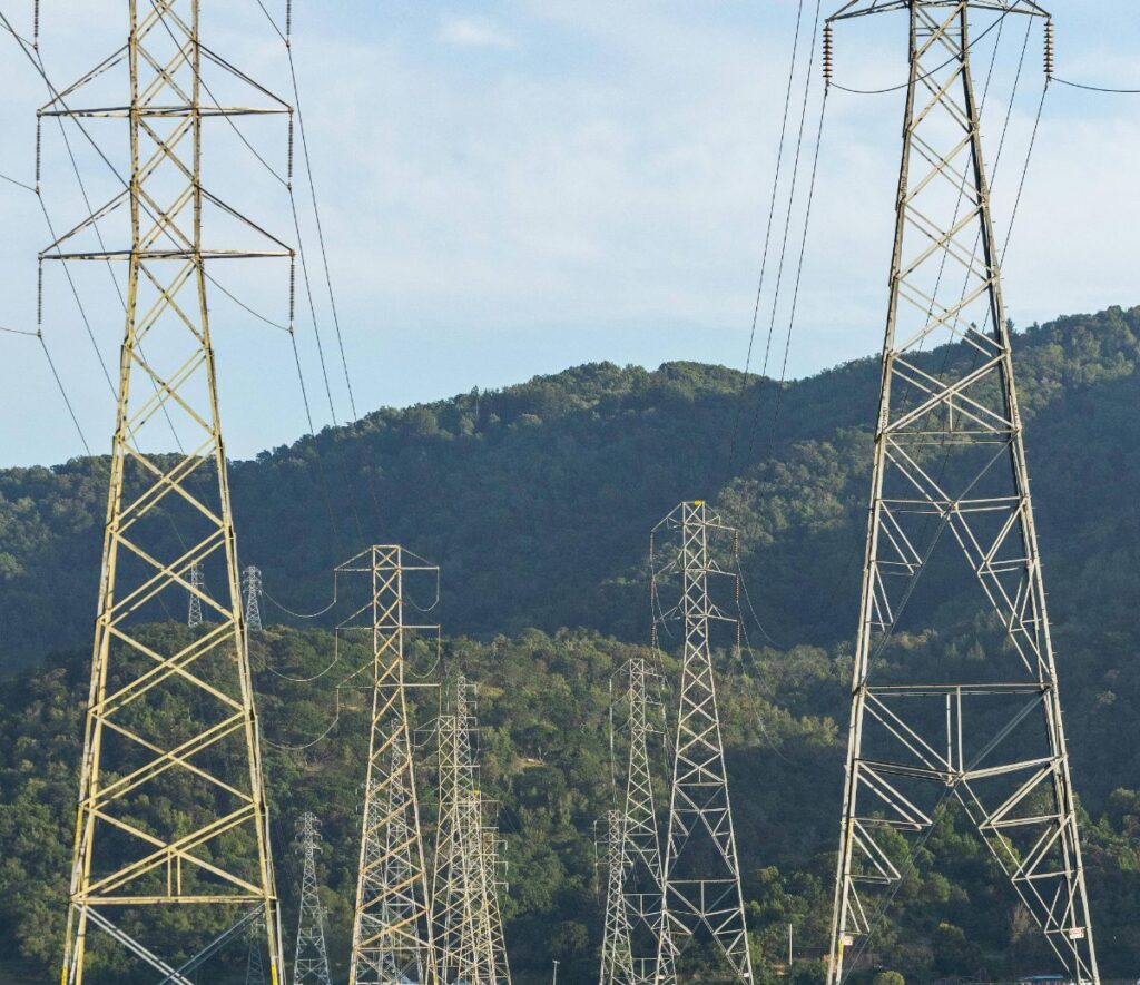
Transmission Line Longitudinal Profiling (Pune, India)
We generated engineering-grade profile maps for High-Voltage (HV) transmission corridors. By fusing Digital Elevation Models (DEM) with ground alignment surveys, we visualized tower spotting, sag curves, and ground clearance.
Deliverables: CAD/GIS integrated formats for Design Validation and Right-of-Way (RoW) approvals.
Irrigation Network Design & Hydraulic Planning (Pune, India)
Supporting irrigation modernization, SeerMaps utilized GIS to design Pipe Distribution Networks (PDN) and Chak layouts. We analyzed command area topography to optimize pipe sizing and gravity flow alignments.
Outcome: Enhanced water conveyance efficiency and minimized transmission losses in the canal command area.
Command Area Development (Tasgaon & Karad)
Advanced Remote Sensing & AgTech
Drone Analytics & Precision Agriculture (India)
Leveraging UAV photogrammetry, SeerMaps processed multispectral imagery to generate orthomosaics and vegetation indices (NDVI/NDRE). We performed plot-wise attribute mapping to assess crop vigor and stress.
- Technical Scope: Image processing, spectral analysis, and yield estimation modeling.
- Outcome: Provided stakeholders with data-driven insights for precision farming and insurance assessment.
Urban Building Footprint Extraction (Prasad Surveys)

Enterprise GIS & Data Services
Cartographic Delineation & Data Conversion (Maharashtra)
Web-GIS Implementation (EI Technologies)
Survey Support & Asset Mapping (Various Clients)
From “Accord Surveys” to “Rajas Construction,” SeerMaps serves as the geospatial backend for civil engineering firms. We provide:
- High-Accuracy DGPS/RTK Surveys: For precise asset tagging.
- Data Structuring: Converting raw field coordinates into structured geodatabases.
- Site Optimization: Base maps and contour analysis to reduce construction rework.
AMRUT Urban Reform Mapping