
Advanced Geospatial & GIS Services for the Digital Age
SeerMaps Technologies delivers cutting-edge geospatial and GIS solutions designed to empower government agencies, urban planners, infrastructure developers, and engineering firms across India, Australia, and the USA. Our services harness the latest technology trends, including AI, UAV surveying, and digital twin engineering, providing actionable spatial intelligence for smarter decision-making and sustainable development.
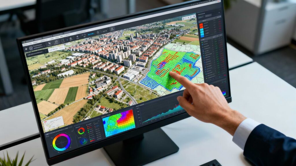
Geospatial Analytics
SeerMaps delivers end-to-end spatial data analytics and mapping for government, infrastructure, and utilities clients. Our team converts scattered geodata into decision-ready layers, dashboards, and planning tools aligned to engineering workflows.
Sub-services
- Base mapping and vector data creation (topographic, thematic, zoning)
- Land use / land cover mapping and change detection
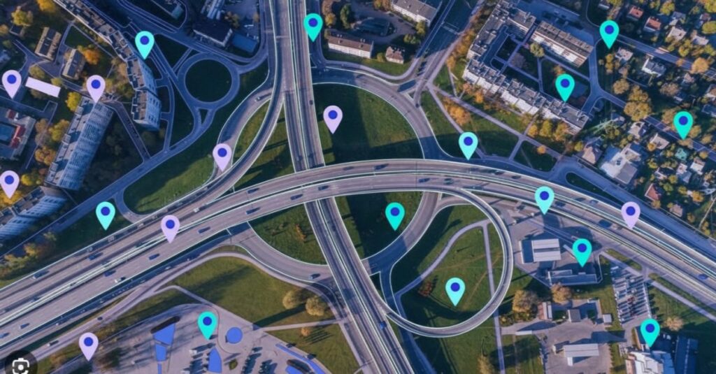
- Location intelligence and hotspot analysis for infrastructure and services
- Network analysis (access, coverage, catchment areas, routing)
- Custom web maps, dashboards, and reporting for stakeholders
- Data cleaning, georeferencing, and spatial accuracy improvement
- Base mapping and vector data creation (topographic, thematic, zoning)
- Land use / land cover mapping and change detection
- Location intelligence and hotspot analysis for infrastructure and services
- Network analysis (access, coverage, catchment areas, routing)
- Custom web maps, dashboards, and reporting for stakeholders
- Data cleaning, georeferencing, and spatial accuracy improvement
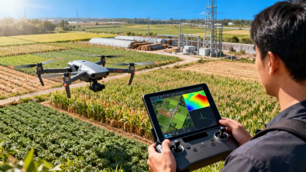
Remote Sensing & UAV
This service combines satellite imagery, aerial photogrammetry, and drone surveying to deliver high-precision terrain and asset information for planning and monitoring. It supports irrigation, agriculture, utilities, and infrastructure projects.
Sub-services
- Drone-based corridor and area surveys for engineering design
- Orthomosaic generation and high-resolution base imagery
- Digital Elevation Models (DEM/DSM) and contour extraction
- Multispectral and NDVI analysis for crop health and vegetation
- Change detection for construction monitoring and compliance
- Image classification for land cover, encroachments, and resource mapping
Utilities & Land Records
SeerMaps supports departments, utilities, and municipalities in modernizing land and asset records with accurate, GIS-ready datasets. This underpins smart billing, planning, and service delivery.
Sub-services
- Cadastral and parcel mapping (digitization, edge-matching, spatial corrections)
- Utility network mapping (water, wastewater, storm, irrigation, power)
- Asset inventory and GPS-based feature surveys
- Integration of revenue records, ownership, and attributes with spatial data
- Data models and geodatabases for land and utility information systems
- Support for e-governance programs (Svamitva, AMRUT, Jal Jeevan-type initiatives)
Digital Twin Engineering
This service integrates GIS with engineering design to create living, spatially accurate models of infrastructure and cities. It helps agencies and developers simulate, plan, and manage assets over their full lifecycle.
Sub-services
- 2D/3D base models for canals, pipelines, roads, and urban areas
- Digital twin models for smart city zones and critical infrastructure
- Integration of survey, BIM/CAD, and GIS datasets
- Hydraulic and network modeling support (irrigation, water distribution)
- Scenario analysis for expansion, rehabilitation, and risk
- Dashboards for performance monitoring and asset lifecycle planning

GIS Consulting & Apps
SeerMaps acts as a strategic GIS partner, helping organizations plan systems, build applications, and integrate geospatial capabilities into existing workflows and platforms.
Sub-services
- GIS strategy, roadmap, and architecture consulting
- System design, technology stack selection, and implementation planning
- Custom web and mobile GIS application development
- Integration with ERP, project management, and e-tendering systems
- Migration from legacy maps/CAD to modern GIS platforms
- User training, documentation, and ongoing support

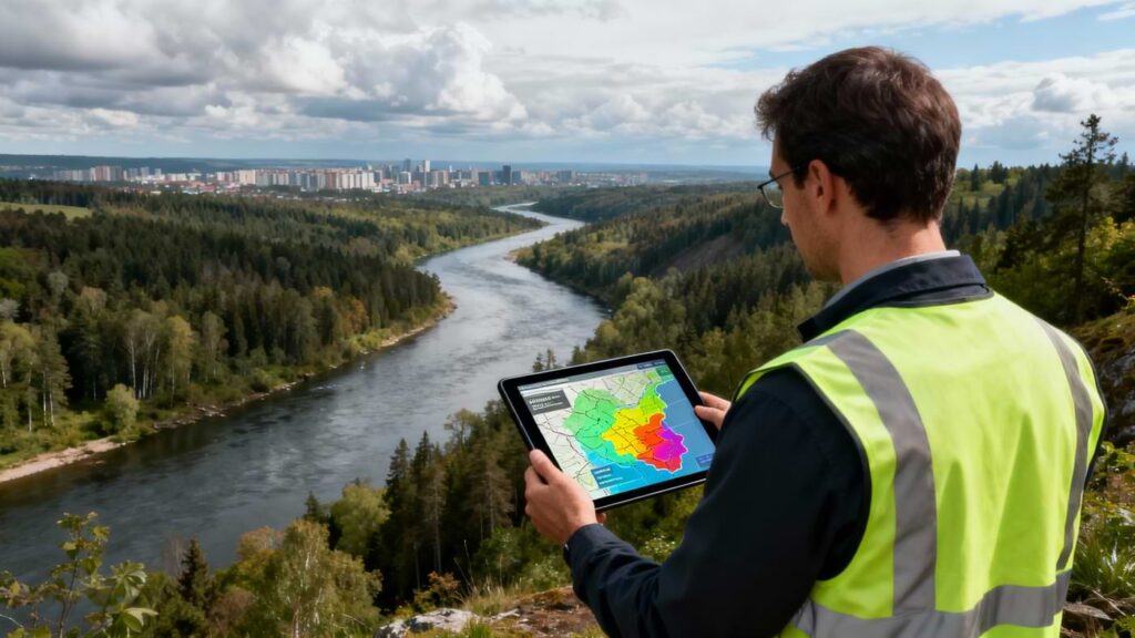
Environment & Risk
This service focuses on environmental intelligence and disaster risk, supporting regulators, municipalities, and NGOs with spatial evidence for resilience and sustainability.
Sub-services
- Flood, drought, and landslide susceptibility mapping
- Watershed, catchment, and drainage analysis for planning
- Environmental impact assessment support using geospatial layers
- Habitat/landscape analysis and conservation planning inputs
- Monitoring of land degradation, deforestation, and encroachment
- Risk dashboards for emergency response and mitigation planning
IT & Web GIS Solutions
SeerMaps delivers IT solutions that blend modern web development with geospatial intelligence, building secure, scalable platforms for municipalities, utilities, and corporate clients. Our team develops websites and Web GIS applications that turn complex spatial data into intuitive, day-to-day tools for decision-makers.
Sub-services
- Corporate Web Development: Professional, responsive websites for engineering, surveying, infrastructure companies and other businesess.
- Municipal Web GIS Portals: Online map portals for land records, utilities, and urban services with role-based access.
- Custom App Development: Tailored web applications for e-governance, tender management, project tracking, and asset management.
- Integration & APIs: Connecting web apps to existing databases, ERPs, and GIS systems through secure interfaces.
Why SeerMaps?
- Integration of the latest AI and UAV technologies
- Proven international experience across diverse regulatory environments
- Cost-effective, scalable, and end-to-end GIS and digital engineering solutions
- Client-centric approach focused on measurable project outcomes
Partner with Us
Harness the full potential of spatial intelligence with SeerMaps Technologies. Contact us today for a consultation or explore how our geospatial expertise can drive your next project to success.